Feeling Like Spring
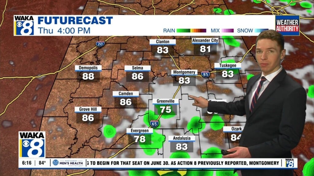
A strong ridge has set-up across the Southeast, and it looks very similar to a summer pattern. The rest of this week and into the week, the ridge is going to continue to allow for more spring-like warmth for us all. Afternoon highs are going to be in the mid to upper 70s each day. These temperatures are getting close to record levels, but should remain just below records for most of us. However, the temperatures are going to be 15-20 degrees above average for January. Though we are dealing with a few showers today, the main moisture axis and associated rain and storms will remain north and west of the state. Tomorrow, through the weekend, the days will feature a mix of sun and clouds. A shower or two will certainly be possible, but nothing too widespread or heavy.
INTO NEXT WEEK: The ridge begins to weaken and break down next week, but it looks as though our next best chance of rain will be closer to midweek. Next week’s rain chances begin to increase Tuesday, with our the better rain chances arriving Wednesday and Thursday. Not an overly impressive rain event, but should be the best chance the next 7-10 days. We should see our highs drop back into the 60s by then, and we are not expecting any severe weather. Through the forecast period, there continues to be no signs of Arctic air returning to Alabama. However, the global weather pattern is suggesting colder air will return to Alabama towards the end of the month. Again, don’t go letting your guard down, there is still a lot of winter left, and February is notorious for being cold in Alabama.
Be sure to stay connected throughout the day and night follow me on twitter: @Ryan_Stinnett and Like my Facebook Fan Page “Meteorologist Ryan Stinnett.”
Have a great day!!!
Ryan