Storms this Morning, Very Warm Days Ahead
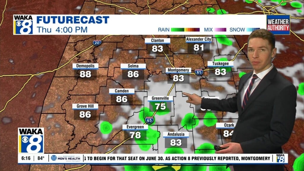
THURSDAY AFTERNOON: The rain and storms will be coming to an end before noon today for most of us, and we are going to see a clearing sky through the afternoon. Drier and slightly cooler air filters into the state tomorrow and we should see highs in the lower 80s.
FRIDAY/SATURDAY: A ridge builds back into the area to end the week, and we warm back up, well into the upper 80s for highs. Friday and Saturday looks dry with more sun than cloud, and overall beautiful weather for the final weekend of April. Any outdoor plans or events you have this weekend, try to get them completed on Saturday, as Sunday looks to be stormy.
MORE STORMS SUNDAY: On Saturday, our next storm system develops in the Southern Plains, where a significant severe weather event will unfold, and this system will bring rain and storms to Alabama Sunday. This storm system to the west will push strong to severe thunderstorms into Alabama for the second half of Sunday, and as of now it looks like the main event will come between 12PM until midnight Sunday. Lots to watch with the system, and still too early to know exact threats.
INTO THE NEW MONTH: The month of May will start off very nice, with dry and comfortable weather. Monday and Tuesday look to have highs in the 70s with lows in the 50s, while those typical colder spots should be in the 40s early Tuesday morning. It still looks as though the next chance rain and storms will come later in the week, most likely on Thursday as our temperatures return to the 80s.