A Cold Rain at Times Today
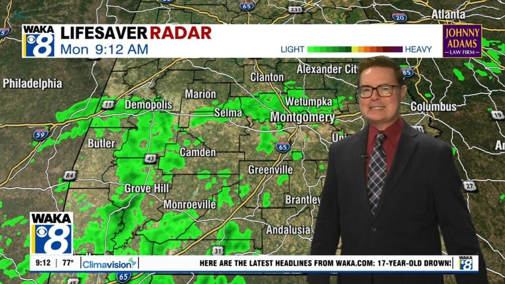
Today will be a cold and wet day, with brisk winds out of the east at 10-20 mph. We will see periods of rain throughout the day, a steady soaking rain for many of us with rainfall totals around 1/2 inch are expected. Highs today will hold in the upper 40s and lower 50s. With the cold, stable air, there is no threat for severe weather and likely no thunder. Tonight will be cloudy and cold with lingering showers; lows around 40° are expected.
FOUL FRIDAY: Tomorrow looks to be a rather raw winter’s day…expect lingering areas of light rain to start the day, with the sky likely staying cloudy all day and temperatures struggling to reach the upper 40s for many locations. Factor in northerly winds, and it will feel even colder. The sky should finally clear Friday night, allowing temperatures to fall to near freezing for many of us.
WEEKEND WEATHER: Saturday will start off cold, with a frosty conditions, the day will feature partly sunny conditions with highs in the 40s. More of the same on Sunday, with a mix of sun and clouds, it stays dry Sunday, with highs holding in the 40s. Clouds begin to increase late Sunday ahead of the next rainmaker.
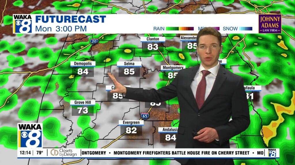
MONDAY SYSTEM: Models are coming into better agreement finally and it does look like we are in store for a cold rain on Monday, with the threat for some winter weather mischief across North Alabama, north of Birmingham.
As of the morning, but the GFS (American) model and the European model show the low tracking along the Gulf Coast, which means rain is likely across the state. And these model runs are warmer as well, so for now, it would be just a cold rain for much of the state, with the chance of some wintry precip across North Alabama.
Again, this is still several days out and we continue to watch future model runs, stay tuned for future updates, but for now, the forecast for Monday will feature another widespread soaking rain for Alabama with temperatures only in the 40s for most of Central and South Alabama.
REST OF NEXT WEEK: Dry weather returns on Tuesday, and the weather will remain cool and dry before more rain returns towards next Friday. Highs will be in the 50s, with lows in the 30s.
VOODOOLAND: Over the next few weeks, the long range models suggest that we will be dealing with more cold air with a more northwesterly flow into the state. That means for you snow lovers, there is still a chance for moisture to move north from the Gulf and interact with the colder air, and perhaps give you some wintry precipitation, but again, this is not a forecast.
Stay warm and dry today!!!
Ryan