Quiet Start to the Week
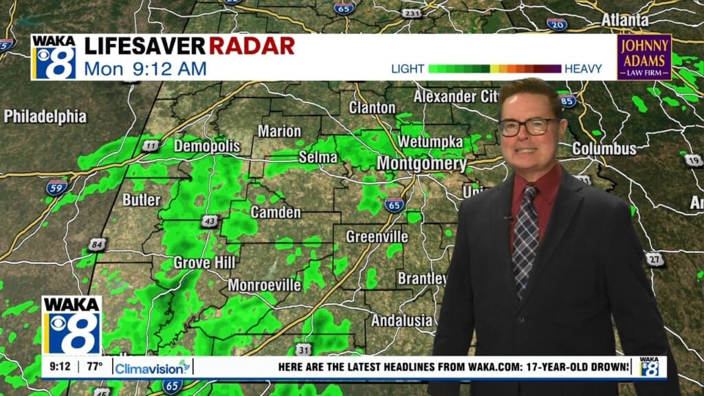
TO START THE WEEK: Today will be sunny and dry with highs mostly in the mid to upper 50s. Tomorrow, a front will drop into Alabama and cause clouds to increase through the afternoon, but limited moisture means we stay dry tomorrow with highs the mid to upper 60s. Tomorrow night, we will mention the chance for some scattered showers along the frontal boundary as it stalls across Central Alabama.
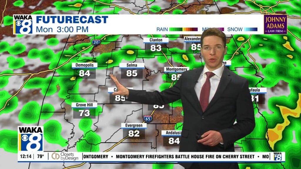
THE PATTERN GET MORE ACTIVE: Much of Wednesday will be dry, but a deepening over the Great Lakes region may cause another impulse to move across Central Alabama, bring with it another chance of a few showers during the evening through the overnight hours. Highs will be in the low 60s. The energy from that trough will continue to pump moisture into Central Alabama on Thursday, keeping rain likely at times throughout the entire day. Highs will be in the lower 60s. Friday will continue to have a decent chance of showers as the pattern continues to hold pretty steady at this point. While all of Central Alabama will have a chance of rain, the best chances will be over the southern half of the state. Highs continue to hold in the the 60s.
WEEKEND WEATHER: Saturday may actually turn out to be a dry day as the latest GFS has backed off of any moisture entering the area until the next day. However, I wouldn’t be surprised if a stray shower works its way into the area after sunset. Highs will be in the lower 60s. Another good chance of showers looks to move back into Central Alabama late Sunday as another disturbance moves through the area. With perhaps a more potent system to start next week.
Have a mysterious Monday!!!
Ryan