A Taste of Winter Today
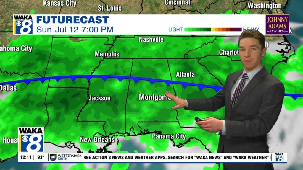
The deep, upper low will be just north of Alabama today and the day will be cloudy, chilly, and breezy with temperatures in the mid 50s. Areas of light rain will persist across the area as well and with those gusty winds of 10-20 mph, it will feel much chillier. With temperatures twenty or so degrees below average, today will look and feel more like a late December day verses a late October Day.
FRIDAY NIGHT LIGHTS: For the high school games tonight, the sky will be cloudy with some light rain possible; temperatures will hover in the low 50s, so make sure you take the jackets and blankets.
HALLOWEEN WEEKEND: Clouds and some light rain will linger into tomorrow, especially over the northern half of the state. Across South Alabama, we will forecast gradual clearing tomorrow afternoon as the upper low lifts away. Saturday will stay cool with a highs holding in the upper 50s and low 60s. Sunday will be a much better day of weather as sunshine returns in full supply, we are forecasting temperatures to return to the upper 60s and lower 70s statewide.
ALABAMA STATE VS ALABAMA A&M (2:30p CT kickoff at Birmingham’s Legion Field): The sky will be mostly cloudy for the Magic City Classic with a touch of light rain or drizzle at times; temperatures will be in the mid to upper 50s.
OLE MISS AT AUBURN (6:00p CT kickoff at Jordan-Hare Stadium): Mostly fair with temperatures falling from near 54 degrees at kickoff, into the upper 40s by the second half.
HELLO NOVEMBER: The new month starts off with pretty nice weather, as the week looks dry with pleasant days and fair nights…highs in the 70s, while lows in the 40s/50s are expected. Our next chance for rain and storms looks to be one week from today on Thursday or into Friday.

IN THE TROPICS: Showers and thunderstorms associated with a strong low pressure system located a few hundred miles south-southwest of Cape Race, Newfoundland, continue to show some signs of organization. However, the low is still attached to a front and therefore remains nontropical. The low is expected to move eastward and then southeastward toward slightly warmer warmers during the next few days, and it could lose its associated fronts and acquire some subtropical characteristics over the weekend or early next week while over the central Atlantic. Formation chance through 5 days…low…30 percent.
Stay warm today!!!
Ryan