More Heavy Rainfall Likely This Week
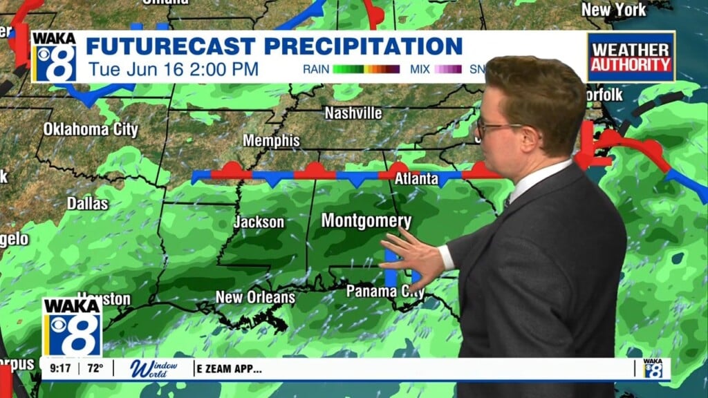
A potential drought buster is underway across our area and all indications are it sticks around through the end of this week. Periods of rain and t-storms are likely each day. Rainfall potential will range between 4 to 7 inches before its all done later this week. We suggest you keep the rain gear handy.
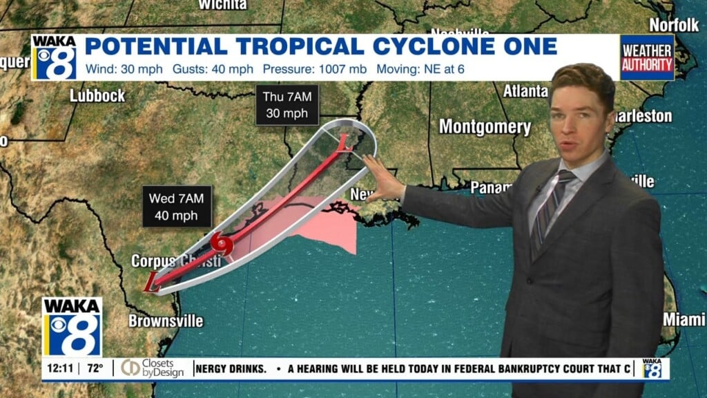
A stalled frontal boundary will dissipate over the state but gulf moisture will remain and continue to fuel showers and t-storms Wednesday. The NHC has a tropical system becoming a brief tropical storm Wednesday afternoon. It would be named Arthur and we will more than likely see some of its impacts. The tropical system will enhance the rain chances over the region Thursday into Friday. We will be on the right side of the circulation and that would put us in a spot for a severe storm threat. The Storm Prediction Center has placed our entire area in a marginal risk ( 1 out of 5) for severe storms Thursday through early Friday.
We expect to be on the backside of all the rainfall over the upcoming weekend. Scattered showers and t-storms will be possible but the persistent rainfall will be to our east and moving away. There are signs we move back into a hot weather pattern with fewer showers and storms around early next week.