Spring is in the Air
SPRING IS IN THE AIR: An upper air ridge is in place over the Gulf Coast States and that means we are going to stay dry and mainly sunny with a gradual warming trend. Highs today surge into the mid 70s area wide with upper 70s Wednesday, and highs in the lower 80s Thursday and Friday. This is certainly looking like the best week of weather so far this year, and unusually quiet for March in Alabama, which is typically the wettest month of the year for much of Alabama.
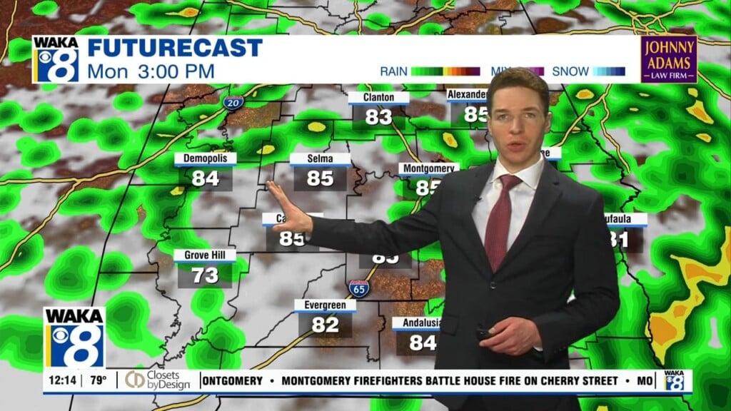
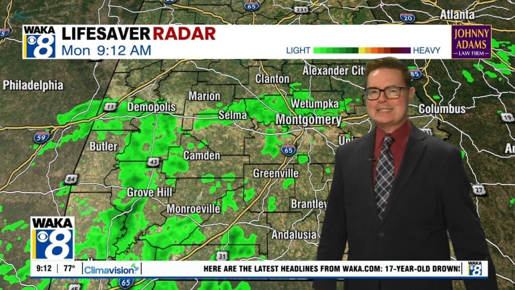
THE ALABAMA WEEKEND: The dry pattern stays in place into the weekend, but moisture levels will be on the rise as more clouds roll into the state. Saturday will be a partly sunny, warm day with a highs again in the low 80s. Sunday looks dry, but clouds will likely increase, and we will bring in a chance of rain and thunderstorms Sunday night and into Monday across Alabama. We do note that SPC has parts of Arkansas and Louisiana in a severe weather risk in their “Day 6” outlook for Sunday, but for now it looks like the dynamics will be weaker as the system moves into Alabama. Certainly sometime to keep an eye on as the week progresses as we are in the heart of our spring severe weather season.
NEXT WEEK: The pattern becomes more active as the ridge weakens across the region. After a chance of rain or storms Monday, another system looks likely over the second half of the week. Too early know if severe thunderstorms will be an issue, but again it is the season. Highs through the week will in the 70s most days.
Have a Tuesday unlike any other!!!
Ryan