Cloudy, cool weather with rain at times continues through Sunday
Friday afternoon remains mainly cloudy and cool with rain, mainly south. Temperatures only warm into the low 50s. Rain coverage may decrease, but a few showers linger Friday night. Temperatures only fall into the mid 40s or so, with a cloudy sky otherwise. Rain coverage increases again Saturday, but likely remains mainly near and south of highway 80/Interstate 85 once more. Temperatures remain cool with highs in the 50s.
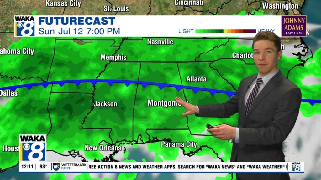
Clouds may clear partially Saturday night, allowing fog formation if so. Otherwise, clouds increase again Sunday, with another round of rain Sunday night. Otherwise, temperatures remain cool, with highs in the 50s to perhaps low 60s. Sunday night lows fall into the 40s. Clouds finally break apart a bit Monday. Tuesday looks mostly sunny. However, temperatures remain cool, with highs in the 50s, and lows in the 30s both days.
Wednesday now looks like a dry day, with a partly to mostly sunny sky. Temperatures trend a bit warmer for the latter half of the week, with highs in the mid to upper 60s Wednesday through Friday. Thursday and Friday also look dry with a partly to mostly sunny sky. Next weekend still looks dry with a partly to mostly sunny sky at this time. Meanwhile, temperatures remain cool, with highs in the low 60s and lows in the low 40s.