Awesome April Weather
[gtxvideo vid=”Mj95cFYS” playlist=”” pid=”2gxTqEDg” thumb=”http://player.gtxcel.com/thumbs/Mj95cFYS-120.jpg?cachebust=1459741506805″ vtitle=”4/3/16 Ryan 10PM Forecast”]
It was a chilly start to our Sunday this morning. The clear sky did allow for radiational cooling and we saw temperatures in the lower and mid-40s this morning. Our winds did stay up last night, and that kept the boundary layer mixed, which prevented temperatures from falling as low as they could have. It has been another day with abundant sunshine and blue sky as far as the eye can see. After the cold start this morning, most locations across South Central Alabama saw temperatures climb into the upper 60s and lower 70s. An area of high pressure is centered over the Tennessee Valley, and will continue to allow for splendid spring weather the next few days. Hope everyone was able to get out and enjoy this awesome spring weather today!
THE WEEK AHEAD: For the first full week of April, overall I think most people are going to be happy with the forecast. A quick weather summary for the week, it starts off dry, there will be a chance for midweek rain and storms, then dry weather returns to end the week, with another chance of frost for portions of the state. Lets break this forecast down.
MONDAY/TUESDAY: These two days will be fantastic. Tomorrow morning will have another chilly start, as most locations will be in the mid 40s. Under a mix of sun and clouds, highs should make it into the mid and upper 70s for Central Alabama. Also tomorrow, a frontal boundary will make its way south and will make its way into the state. This boundary will be moisture starved and therefore rain is not expected, but there should be a few additional clouds that accompany the front. The sky will clear for Monday night, and temperatures will be in the upper 40s and lower 50s, with highs Tuesday afternoon once again in the mid and upper 70s with a sky filled with sun.
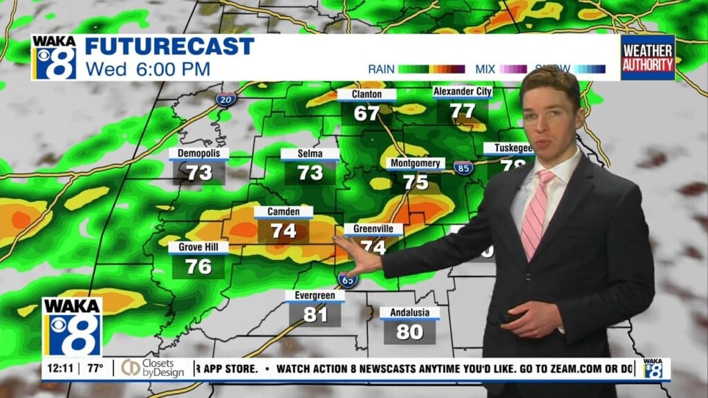
WEDNESDAY/THURSDAY: Our rain chances increases as we head toward the middle part of the week. A storm system will be moving out of the Rockies, across the Northern Plains and into the Midwest. Once again, a cold front will be trailing behind the system and will bring the chance of showers and storms to Alabama late Wednesday and into Thursday. First off, much of the day Wednesday will be dry, but southerly flow will increase and that will allow our moisture levels to increase. Overnight Wednesday, we are going to see rain and storms move across the state of Alabama. Good news is that severe weather is not expected as the better dynamics will be well north of the state, and instability values will be rather low for this time of year. Thursday will start off with lingering showers/storms and clouds, but by the afternoon sunshine will return as drier air settles back into the state. Model output below shows much of the viewing area could receive one-quarter to three-quarters of an inch of rain from this system.
FRIDAY: Another cool snap is expected as we head towards that second weekend in April. Cold front clears the state late Thursday and that will allow for a cool start to Friday with 40s expected. After 70s for much of the week, afternoon highs look to stay in the 60s, and it also looks to be breezy day as well. However, the day will feature plenty of sunshine.
WEEKEND WEATHER: A deep trough will develop over the eastern U.S. and that will allow for cold air to slide south out of Canada. The good news is that the long range models continue to keep the axis of the trough north and east of Alabama which means the coldest weather will be located there as well. Nevertheless, it still looks as though 30s will once again show up in the state of Alabama. Saturday and Sunday will have chilly starts to the day, but both days will have abundant sunshine. Highs Saturday will be in the upper 60s and lower 70s, while mid 70s are expected on Sunday.
LONG RANGE: The GFS shows a potent storm system impacting the state and Southeast Tuesday and into Wednesday (April 12/13). The placement of the low is favorable for the threat of severe weather so that will definitely be something to watch next week. Any system this time of year needs to be watched. April is the heart of our severe weather season and is our top severe weather month in Alabama. After next week, the pattern becomes more zonal (west to east) and that should allow for a warming trend in our temperatures and after next weekend, we may be done with the colder temps and looking at the two week temperature trend, that certainly looks likely.
Have a great night, and enjoy the wonderful week of weather ahead.
Ryan


