Temperatures Are on the Way Up
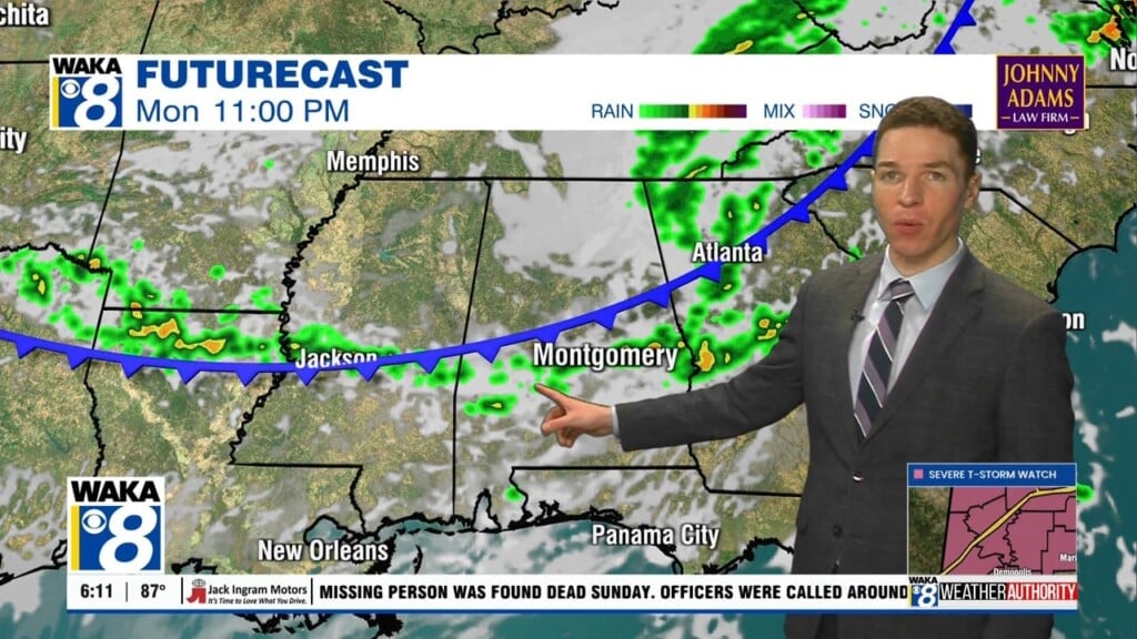
SO LONG FREEZING TEMPS: After this morning, most of will not be close to the freezing mark again for the next eight days. A major pattern shifts will allow for a persistent southerly flow to cover Alabama and that means well-above average temperatures are here through at least the weekend. The main moisture axis will remain to the west of the state, and that will keep the heaviest and most widespread rain west of Alabama. However, we are going to have to deal with the occasional passing shower from time to time due that southerly flow. We are also going to have to deal with more clouds as well and the clouds will certainly be on the increase tomorrow. A few showers are possible the northern third of the state tonight and Wednesday, but amounts won’t amount to much. Highs tomorrow will be in the lower 60s, with lower 70s Wednesday.
SENSATIONAL 70S: Hard to believe we are going to see such a temperature change especially after the brutal cold over the weekend. We all know that in Alabama it never gets cold and stays cold, and that is certainly the case this week. It appears much of Central Alabama will be feeling like spring to end the week as both Thursday and Friday should see highs into the mid and upper 70s, with lows only in the 50s. We are going to continue see a sky with more clouds than sun, with an isolated shower possible.
THE ALABAMA WEEKEND: The models have backed off our rain chances for the weekend as the ridge remains in place, and the spring-like weather to end the work week will likely extend into the upcoming weekend. Highs both Saturday and Sunday should be in the mid 70s as the upper ridge will continue to be dominant feature impacting our weather. We could certainly see a shower or two over the weekend, but we really think the next significant chance of rain hold off until next week.
NEXT WEEK AND BEYOND: The long range global models are hinting that the ridge over the Southeast will begin to break down early next week, which would allow for a more active weather pattern to return to the state. The GFS shows a more widespread rain event in here by Tuesday and Wednesday of next week. Beyond that, it appears the next couple of weeks of January will be relatively mild with no Arctic air invasion for the Southeast. Certainly some good news as I’ve already had my fill of winter temps after this weekend. However, there is still a lot of winter left, and February is notorious for being cold, so don’t think you can be the winter gear away yet.
Be sure to stay connected throughout the day and night follow me on twitter: @Ryan_Stinnett and Like my Facebook Fan Page “Meteorologist Ryan Stinnett.”
Have a great day!
Ryan