Grab the Rain Gear, Wet Thursday and Friday Ahead
Clouds returned to Alabama overnight and the weather has turned wet for today and tomorrow for the entire state. Expect periods of rain and cloudy conditions both days with highs in the 50s. There is no risk for severe storms, and probably no thunder as the air will be stable. Rainfall totals through Friday will around one inch, with isolated higher amounts of two inches possible, especially across South Alabama.
WEEKEND WEATHER: Saturday will be a dry day with a partly sunny sky and highs in the low 60s. On Sunday, a warm front will lift north from the Gulf in response to a developing system to our west, allowing moisture levels to rise and clouds to return with showers increasing through the afternoon hours. Highs Sunday will be in the 60s.
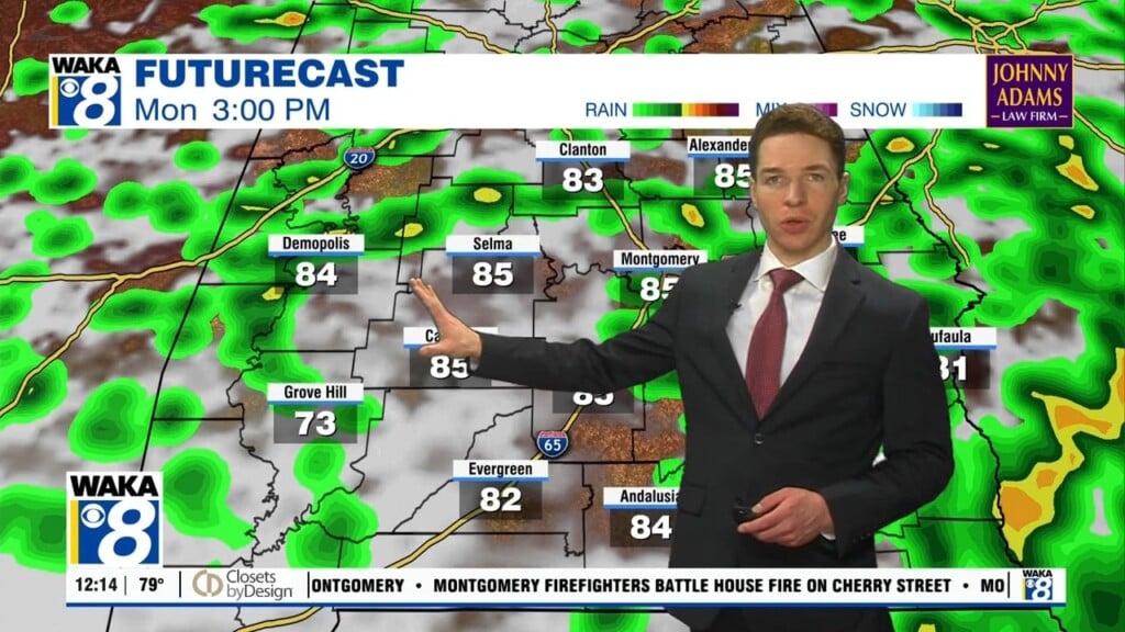
WET/STORMY MONDAY: Widespread rain and some storms are expected as we head through the day on Monday as the next storm system heads east. There remains a bit of difference in the models as the European shows a deep surface low tracking northwest of Alabama, with a warm, moist, unstable airmass across Alabama as temperatures surge into the 70s. This could mean some potential for strong, maybe even severe thunderstorms. However, the the American GFS, shows the low father south with just rain with some thunder for the state. Of course we will watch trends in the coming days, but just something to note for now as we should see rain and storms statewide Monday into. Monday night.
REST OF NEXT WEEK: The rain comes to an end early Tuesday, but another system looks to bring rain back to the state for Wednesday and Thursday. Look for seasonal temperatures, as highs will be in the 50s and 60s with lows in the 30s and 40s; pretty close to where they should be this time of year. Looking through the rest of the month, still no signs of any bitterly cold air or winter weather mischief for Alabama.
Have a Thursday full of magic!!!
Ryan