Still Hot and Less Humid to End the Week
Friday is starting off still fairly warm with some clouds overhead with a hot afternoon still in store for us. But drier air will be in place on the back side of the frontal system that moved through yesterday. Highs will be in the upper 80s and lower 90s with mostly sunny skies. Clouds will be passing by tonight with lows in the low to mid 60s.
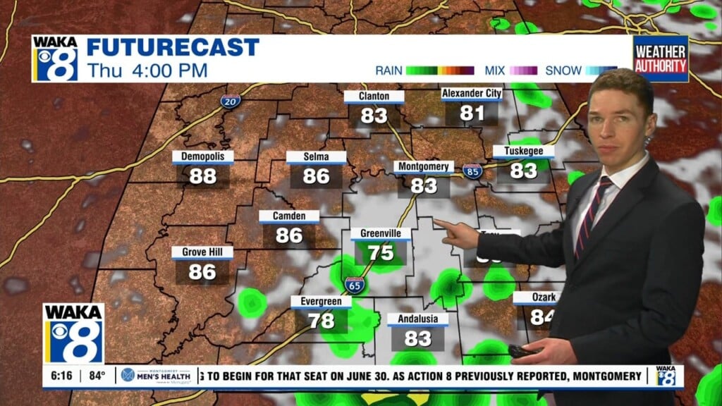
Saturday will start off calm with some passing clouds but Thursday’s frontal system will stall near the coast and allow rain chances to rise for our southern counties. Most of our communities will be in the low 90s for highs.
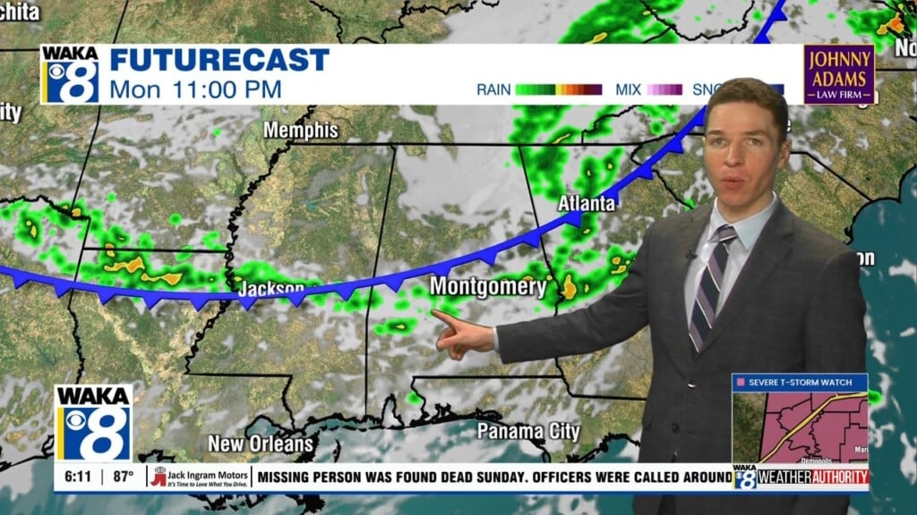
Another system will be arriving on Sunday and will likely bring widespread showers around the area for Sunday as well as Monday. Next week looks fairly active with above normal chances for rain nearly every single day.