Wind Advisory Today; Winter-like Weather Tomorrow
Behind the front today, we should see sun for several hours with very blustery conditions and a wind advisory has been issued for much of Alabama as winds will be in the 15-35 mph, with higher gusts.

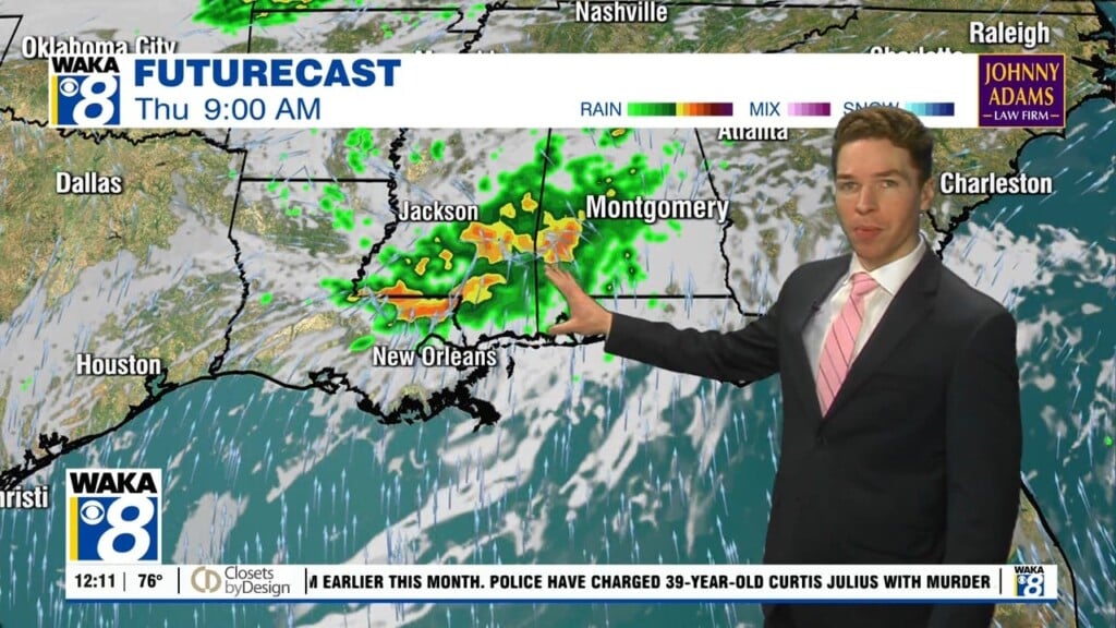
By later this afternoon, the clouds will move back in fast and scattered patches of light rain are expected due to an upper level low spinning over the South. Highs today will be in the upper 60s and low 70s.
RAW, WINTER-LIKE FRIDAY: The deep, upper low will hold over the region Friday and our Friday will remain a cloudy, chilly, and breezy day with temperatures struggling to reach the mid and upper 50s, a good twenty degrees below average for late October. Add in gusty winds of 10-20 mph, it will feel much chillier. Light rain is likely at times over portions of Alabama through Friday night.
FRIDAY NIGHT LIGHTS: For the high school games Friday, the sky will be cloudy with some light rain possible; temperatures will hover around 50 degrees at most stadiums.
HALLOWEEN WEEKEND: Clouds and some light rain will linger into Saturday, especially for the northern half of the state. Across the southern half of the state, we will forecast gradual clearing Saturday afternoon as the upper low lifts away Saturday will stay cool with a highs struggling to climb into the low 60s. Sunday will be an amazing day of weather with sunshine in full supply along with a highs returning to the upper 60s and low 70s statewide. .
OLE MISS AT AUBURN (6:00p CT kickoff at Jordan-Hare Stadium): Mostly fair with temperatures falling from near 54 degrees at kickoff, into the upper 40s by the second half.
THE FIRST WEEK OF NOVEMBER: For now the week looks dry with pleasant days and fair nights… highs in the 70s, while lows in the 40s/50s are expected. Our next chance for rain and storms looks to be around next Thursday.

IN THE TROPICS: A non-tropical low pressure system producing storm-force winds is located about 350 miles south of Halifax, Nova Scotia. Strong winds along portions of the northeastern United States coast are forecast to gradually diminish later today as the low moves eastward away from shore at about 15 mph. The low is then expected to turn southeastward toward slightly warmer waters in a few days, and it could acquire some subtropical characteristics over the weekend or early next week while over the central Atlantic. Formation chance through 5 days…low…30 percent.
Have a better day today than yesterday!!!
Ryan