No Weather Complaints to Start November
WELCOME TO NOVEMBER: The new month starts off with fantastic fall weather with sunny, mild, and very nice days, while night will be clear and chilly. Highs through Wednesday will be in the low to mid 70s, while nights will range from the mid 40s to mid 50s. We are dry through Wednesday, but a cold front will bring rain back to the forecast on Thursday.
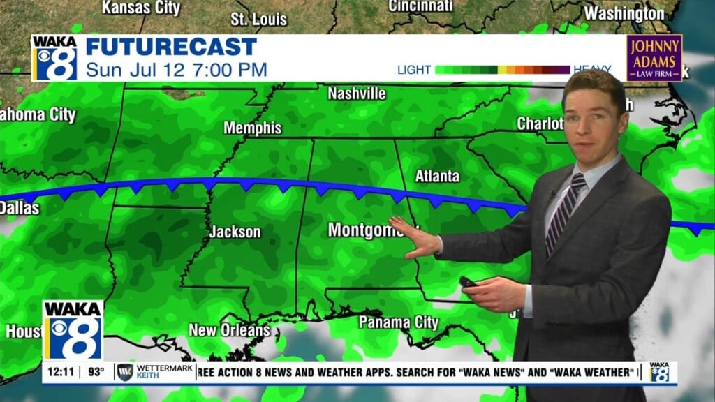
THURSDAY FRONT: A strong front will bring clouds and showers back to the state Thursday. Good news, at this time, severe weather is not expected, and rainfall amounts will be under 1/2 inch due to limited moisture. This system should be in and out of here on Thursday and should provide our only chance of rain the next eight days.
FRIDAY AND THE WEEKEND: On Friday, another surge of very cool and dry fall air settles into the state with for the weekend. This could be the coolest weekend so far this year as afternoon highs will be in the low to mid 60s, while nights could see lows in the upper 30s. The days will be gorgeous with abundant sunshine.
TIME TO FALL BACK: Daylight Saving Time will end this weekend meaning it is time to set those clocks back one hour before heading to bed Saturday night as we will return to Standard Time.
IN THE TROPICS: For the North Atlantic…Caribbean Sea and the Gulf of Mexico: The National Hurricane Center is issuing advisories on Subtropical Storm Wanda, located about 960 miles west of the Azores.

Also, a broad area of low pressure located several hundred miles west-southwest of the Cabo Verde Islands is producing disorganized shower activity. This system is moving into an area of less conducive upper-level winds, and the chances of tropical cyclone development are decreasing. Formation chance through 5 days…low…20 percent.
Have a wonderful week!!!
Ryan