Another Spring-Like Day; Strong/Severe Storms Possible Late Thursday
Today will feature a mix of sun and clouds with an increasing southerly breezy, expect highs to surge into the mid 70s. Tonight will feature passing clouds with lows in the 50s.
SEVERE STORMS POSSIBLE THURSDAY: A dynamic weather system will bring the threat of strong to severe thunderstorms to Alabama Thursday afternoon and evening. The SPC has a “slight risk” (level 2/5) of severe storms defined for areas west of a line from Gadsden to Talladega to Prattville to Camden to Jackson; the rest of the state is in a “marginal risk” (level 1/5).

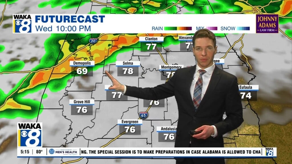
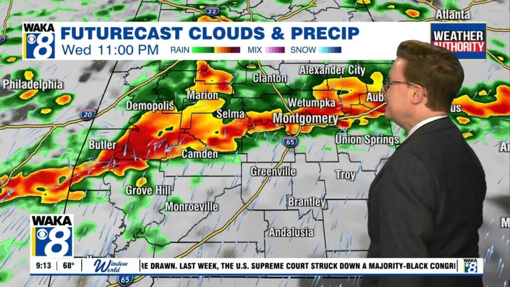
Thursday will be a warm with highs in the mid to upper 70s, and it will be a windy day as gradient winds (not related to thunderstorms) will average 15-25 mph out of the south, with potential for gusts to 30/35 mph. To out west, a line of strong to severe storms will develop ahead of a cold front. These storms will move into Northwest Alabama by early afternoon and will continue to move through the state during the afternoon, evening and overnight hours. For now, the main window for severe storms for Central and South Alabama will come from 4PM until 12AM.
THREATS: There will be ample instability and shear in place, but the main dynamics will be racing off to the northeast and should help at least mitigate our threat in Alabama. However, there is a still enough ingredients in place that storms will be capable of producing hail, strong winds, and a few tornadoes. The higher risk of a tornado is over the “slight risk” across the western half of Alabama, and it looks like there may be an even higher risk for severe storms across portions of Arkansas and Mississippi.
RAIN: Rain amounts of around one inch are likely, but flooding is not expected to be an issue for now as the system will be moving very quickly through the state.
CALL TO ACTION: First of all, this is not uncommon in Alabama this time of year, you just have to be ready and be prepared and make sure you have all aspects of your severe weather safety plan ready for action. Be sure you have a way of hearing severe weather warnings, and an action plan if you are in a tornado warning polygon, take severe thunderstorm warnings seriously too. Have a NOAA Weather Radio in your home and business, properly programmed with a fresh battery in case of power failure. Be sure WEA (Wireless Emergency Alerts) enabled on your phone…this is not an app, but built into every phone sold in the U.S. Check settings, and notifications, and be sure emergency alerts are on. Have the free Alabama News Network Weather App on your phone as a secondary way of getting warnings. Search the App Store for “ANN Weather” if you don’t have it already.

In a site built home, identify the safe place. Small room, lowest floor, near the center of the house, away from windows. And, in that safe place, have helmets for everyone in the family (including adults!), portable air horns, and hard sole shoes. You CANNOT stay in a mobile home if you are in a tornado warning polygon. Know the closest shelter, and how to get there quickly.
Sheltering from a tornado is first priority when it comes to the COVID-19 situation. A tornado is an immediate threat to life; get to your safe place or shelter and do the best you can to protect yourself from exposure to the virus.
FRIDAY AND THE WEEKEND: The sky becomes sunny Friday, and the day will be cooler with a high in the mid 50s. Dry weather continues over the weekend for most of Alabama with mostly sunny days and fair nights; the high Saturday will be in the low 60s, followed by upper 60s Sunday.
NEXT WEEK: Moisture returns Monday, and we will bring in the chance of showers. Then, it looks like there will be some risk of rain each day next week as a moist airmass will over the state. Too early to know if we will see any severe weather threat; rain amounts in the 1-2 inch range look likely Monday through Friday. The week will be mild as temperatures reach the 70s in many places by Tuesday and Wednesday.
Have a wondrous Wednesday!!!
Ryan